
Seismic History Database
Comprehensive archive of global seismic events for research, education, and analysis. All data is verifiable, citation-ready, and sourced from authoritative monitoring networks.
Regional Stress Analysis

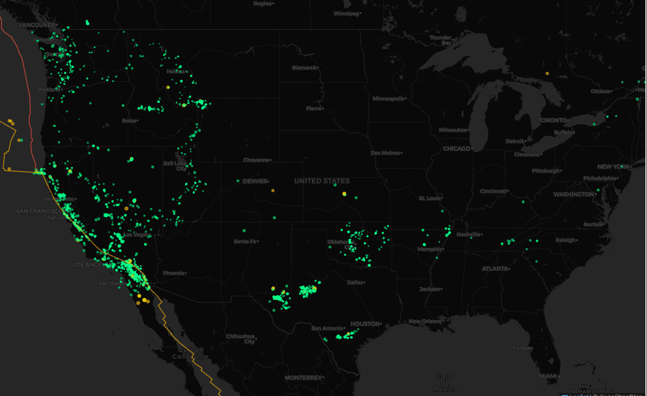
U.S. Historical Seismicity
Tectonic stress fields across the western U.S., showing fault activity density and magnitude frequency distribution.

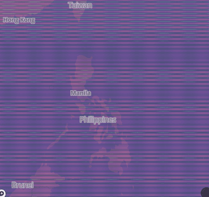
Philippine Stress Plate Map
Stress-field visualization across the Philippine Sea Plate — revealing subduction zone complexity and strain accumulation.
Interactive Data Explorer
| Time (UTC) ▼ | Mag | Lat | Lon | Depth (km) | Place | Source |
|---|---|---|---|---|---|---|
| 2026-01-14T19:42:44.174Z | 2.3 | 60.33 | -140.80 | 5.0 | 105 km NW of Yakutat, Alaska | GSIN |
| 2026-01-14T19:38:18.190Z | 1.0 | 36.02 | -117.82 | 1.5 | 12 km ESE of Coso Junction, CA | GSIN |
| 2026-01-14T19:35:55.920Z | 1.8 | 17.89 | -66.84 | 11.1 | 11 km SSE of Maria Antonia, Puerto Rico | GSIN |
| 2026-01-14T19:34:09.498Z | 1.0 | 57.89 | -154.96 | 78.4 | 46 km NW of Karluk, Alaska | GSIN |
| 2026-01-14T19:30:27.210Z | 1.1 | 35.81 | -117.56 | 5.9 | 15 km WNW of Searles Valley, CA | GSIN |
| 2026-01-14T19:25:11.650Z | 1.1 | 38.83 | -122.79 | 1.7 | 6 km WNW of Cobb, CA | GSIN |
| 2026-01-14T19:17:04.291Z | 2.6 | 60.35 | -153.36 | 168.9 | 55 km ENE of Port Alsworth, Alaska | GSIN |
| 2026-01-14T19:08:32.214Z | 1.3 | 64.98 | -147.34 | 5.0 | 13 km E of Fox, Alaska | GSIN |
| 2026-01-14T19:06:51.443Z | 2.5 | 59.93 | -153.40 | 136.9 | 42 km ENE of Pedro Bay, Alaska | GSIN |
| 2026-01-14T18:49:34.240Z | 0.8 | 38.83 | -122.82 | 1.8 | 8 km NW of The Geysers, CA | GSIN |
| 2026-01-14T18:42:22.140Z | 1.4 | 35.34 | -117.81 | 7.0 | 16 km WSW of Johannesburg, CA | GSIN |
| 2026-01-14T18:40:59.760Z | 0.4 | 38.81 | -122.80 | 1.1 | 5 km NW of The Geysers, CA | GSIN |
| 2026-01-14T18:38:19.392Z | 4.9 | -21.36 | 170.22 | 110.9 | 223 km SSE of Isangel, Vanuatu | GSIN |
| 2026-01-14T18:34:39.409Z | 1.9 | 61.60 | -150.46 | 53.6 | 6 km NNE of Susitna, Alaska | GSIN |
| 2026-01-14T18:32:21.190Z | 1.9 | 18.12 | -66.15 | 25.6 | 1 km ENE of Cayey, Puerto Rico | GSIN |
| 2026-01-14T18:28:32.130Z | 1.8 | 18.11 | -66.14 | 25.5 | 2 km E of Cayey, Puerto Rico | GSIN |
| 2026-01-14T18:21:29.240Z | 1.0 | 33.95 | -116.70 | 11.7 | 9 km ENE of Cabazon, CA | GSIN |
| 2026-01-14T18:20:01.140Z | 1.5 | 45.90 | -122.43 | -0.5 | 1 km SSE of Amboy, Washington | GSIN |
| 2026-01-14T18:18:36.500Z | 0.9 | 48.47 | -123.55 | -0.2 | 3 km WNW of Langford, Canada | GSIN |
| 2026-01-14T18:18:18.360Z | 5.0 | 37.65 | 95.14 | 10.0 | 282 km S of Dunhuang, China | GSIN |
How to Cite This Database
This dataset is provided for educational and research purposes. When using GSIN data in publications, please use one of the following citation formats:
Stone, K. (2025). Global Seismic Intelligence Network — Seismic History Catalog. GSIN Research Portal. Retrieved from https://gsin.dev/seismic-history
Stone, Kent. "Global Seismic Intelligence Network — Seismic History Catalog." GSIN Research Portal, 2025, gsin.dev/seismic-history.
Stone, Kent. "Global Seismic Intelligence Network — Seismic History Catalog." GSIN Research Portal, 2025. https://gsin.dev/seismic-history.
Note: For reproducible research, always include the date accessed and the specific filters used (magnitude range, time period, etc.).
Data Sources & Quality
GSIN aggregates data from multiple authoritative seismic monitoring networks to provide comprehensive global coverage: